


resources
Exploring the 10 Largest States in the US by Area
Industry Expert & Contributor
15 Jun 2025

Ever wondered which states in the US are truly massive? It’s pretty interesting to see how much land some of them cover. We’re going to check out the 10 largest states in the US by area. You might be surprised by some of the names on this list, and just how big they really are.
Key Takeaways
- Alaska is by far the biggest state, taking up a huge chunk of the country’s total land.
- Texas, while famous for being big, is still significantly smaller than Alaska.
- California makes the top three, showing its diverse landscape and large area.
- The list includes a mix of states from different regions, highlighting the varied geography of the US.
- Understanding the size of these states helps put their populations and resources into perspective.
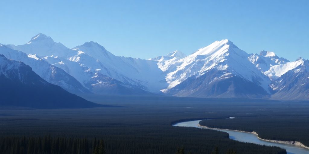
1. Alaska
Alright, let’s kick things off with the big kahuna of US states – Alaska! I mean, seriously, this place is HUGE. It’s so big, it makes Texas look kinda small (sorry, Texas!).
Alaska is the largest state in the United States by a significant margin. Clocking in at approximately 665,384 square miles, it dwarfs every other state in the Union. That’s like, one-fifth of the entire US land area! It’s hard to wrap your head around just how much space that is. Think about it: you could fit several smaller states inside Alaska and still have room to spare.
It’s not just the size that’s impressive, though. The landscape is incredibly diverse, ranging from towering mountains to vast stretches of tundra. You’ve got glaciers galore, rugged coastlines, and dense forests. It’s a nature lover’s paradise, that’s for sure. Speaking of mountains, Alaska is home to Denali, formerly known as Mount McKinley, which is the highest peak in North America. Pretty cool, right?
I remember reading somewhere that if Alaska were to split into two states, both of them would still be among the largest in the country. That’s just mind-blowing!
And let’s not forget about the wildlife! Bears, moose, caribou, whales, eagles… you name it, Alaska’s probably got it. It’s like a real-life nature documentary, except you’re actually there. I’ve always wanted to go on a wildlife tour there. Maybe someday!
Here’s a quick look at Alaska’s area breakdown:
| Category | Area (Square Miles) |
|---|---|
| Total Area | 665,384 |
| Land Area | 570,641 |
| Water Area | 94,743 |
If you’re planning a trip, be prepared to do a lot of driving (or flying!). Things are pretty spread out, and you’ll want to see as much as possible. Just remember to pack your bear spray! And maybe a good map, because getting lost in Alaska sounds like a serious adventure. Don’t forget to check out Alaska’s total area if you want to learn more about the state’s size.
2. Texas
Texas, the second-largest state in the United States, covers a vast area. It’s known for its diverse landscapes, ranging from deserts to forests, and its rich cultural heritage.
Texas is big. Like, really big. You could fit a whole bunch of other states inside it and still have room left over. It’s almost hard to wrap your head around just how much land we’re talking about. It’s not just empty space either; there are bustling cities, quiet small towns, and everything in between. The weather can be just as varied as the landscape, from scorching summers to surprisingly chilly winters, depending on where you are. It’s a place where you can find just about anything, which is probably why so many people call it home.
Texas is more than just its size; it’s a state of mind. There’s a certain independence and pride that you find here, a feeling that anything is possible. It’s a place where people work hard, play hard, and aren’t afraid to be themselves. It’s a state with a strong identity and a unique character that sets it apart.
Here are a few things that make Texas stand out:
- Its unique blend of cultures, influenced by its history and geography.
- The sheer variety of landscapes, from the Gulf Coast to the mountains of West Texas.
- The strong sense of state pride and independence.
Texas is a state that defies easy categorization. It’s a place of contrasts and contradictions, but that’s part of what makes it so interesting. Whether you’re drawn to its big cities, its wide-open spaces, or its unique culture, there’s something for everyone in the second-largest state.
3. California
California, often called the Golden State, clocks in as the third-largest state in the US. It covers a substantial 163,695 square miles. That’s a whole lot of sunshine, coastline, and, well, people! It’s bordered by Oregon, Nevada, and Arizona, making it a key player on the West Coast.
California’s size and location contribute to its diverse geography and climate.
California’s borders weren’t always set in stone. They evolved through treaties and historical events. The Treaty of Guadalupe Hidalgo in 1848, following the Mexican-American War, played a big role. This treaty ceded the area from Mexico to the United States. The border with Oregon was established in 1846, ensuring free navigation along the Columbia River. Nevada’s western border with California wasn’t finalized until 1866.
California is also home to the Sierra Nevada mountain range. It stretches for about 430 miles and includes Mount Whitney, the highest peak in the contiguous United States. The Sierra Nevada boasts rugged peaks, old-growth forests, and beautiful lakes.
California is not just about size; it’s about diversity. From Hollywood to Silicon Valley, from the beaches of Southern California to the forests of Northern California, the state offers a wide range of landscapes and opportunities.
Here are some interesting facts about California:
- It has the largest population of any US state.
- It’s a major agricultural producer.
- It’s a hub for technology and entertainment.
California’s size definitely plays a role in its economic and cultural influence. It’s a state that continues to shape the nation in many ways. You can find more information about California’s borders online.
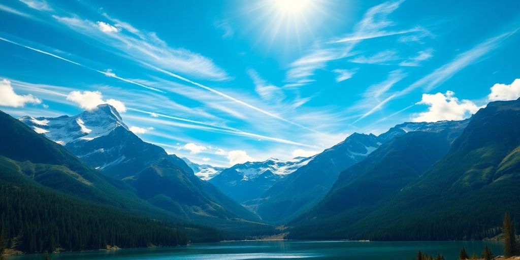
4. Montana
Montana comes in as the fourth-largest state, covering a vast 147,040 square miles. I always thought it was bigger, maybe because it feels so empty when you’re driving through it! Its sheer size contributes to its diverse landscape, from the Rocky Mountains to expansive plains.
Montana’s borders weren’t just drawn on a map; they’re the result of history, treaties with Native American tribes, and a bit of good old-fashioned negotiation (sometimes with military force involved, yikes). The Louisiana Purchase in 1803 played a big role, solidifying the border with Canada as we know it today. It’s kind of wild to think about how much history is tied up in those lines on the map.
Speaking of the landscape, you can’t talk about Montana without mentioning Glacier National Park. Seriously, if you ever get the chance to go, take it. It’s got over 700 miles of trails and some of the most stunning scenery I’ve ever seen. It’s a wilderness area that really shows off what Montana has to offer. The state’s borders developed through treaties and historical events.
Montana is more than just big; it’s a place where the land tells a story. From its mountain ranges to its national parks, it’s a state that demands to be explored. It’s a reminder of the raw beauty and historical depth that the United States has to offer.
5. New Mexico
New Mexico comes in as the fifth-largest state, covering a respectable 121,590 square miles. It’s kind of wild to think about how much space that actually is. You could fit a whole bunch of smaller states in there! It shares borders with Colorado to the north, Utah to the northwest, Arizona to the west, Texas to the east, Oklahoma to the northeast, and even Mexico to the south. Talk about being neighborly!
New Mexico’s history is pretty interesting too. It used to be part of the Spanish Empire, and then it became part of Mexico when they gained independence. It wasn’t until the Treaty of Guadalupe Hidalgo in 1848, after the Mexican-American War, that the U.S. snagged it. Finally, in 1912, New Mexico became an official state.
One of the coolest things about New Mexico is its landscape. Shiprock is a huge, eroded volcanic rock formation that sticks out of the desert. It’s seriously impressive. It’s like nature’s own skyscraper. Standing 1,583 feet tall and covering 13 square miles, it’s a sight to behold and a testament to the state’s grandeur. It’s a great example of the sheer size of the state.
I remember driving through New Mexico once and being blown away by how much open space there was. It felt like you could see forever. The sunsets were incredible, and the stars at night were so bright. It’s a place that really makes you appreciate the beauty of the natural world.
Here’s a quick look at New Mexico’s area breakdown:
| Category | Area (square miles) |
|---|---|
| Total Area | 121,590 |
| Land Area | 121,298 |
| Water Area | 292 |
And here are some things that make New Mexico special:
- Rich history with Spanish and Mexican influences.
- Unique geological formations like Shiprock.
- Diverse culture and vibrant arts scene.
6. Arizona
Arizona comes in as the sixth largest state, covering a hefty 113,990 square miles. It’s sandwiched between California, Nevada, Utah, New Mexico, and Colorado, plus it shares a border with Mexico. I always think of Arizona as this vast, sun-baked landscape, and honestly, it kind of is!
Arizona’s borders weren’t always what they are today. They were first established when it became a U.S. territory back in 1863. After the Mexican-American War, Arizona got even bigger because the U.S. acquired more land from Mexico. It wasn’t until Arizona became a state in 1912 that its borders were officially set, often following natural landmarks like rivers and mountain ranges.
One of the best examples of Arizona’s size? The Grand Canyon, of course! It’s in the northwest corner of the state and stretches 18 miles across at its widest point and 277 miles long. It’s a mind-blowing natural wonder that really puts Arizona’s impressive scale into perspective.
I remember driving through Arizona once and being amazed at how the landscape just kept changing. One minute you’re surrounded by desert, and the next you’re in the mountains. It really gives you a sense of how big and diverse the state is.
Here’s a quick look at Arizona’s size compared to some of its neighbors:
| State | Area (Square Miles) |
|---|---|
| New Mexico | 121,590 |
| Arizona | 113,990 |
| Nevada | 110,572 |
| Colorado | 104,094 |
Arizona is a big state with a lot to offer. From the Grand Canyon to its diverse landscapes, there’s always something new to discover. It’s no wonder people are drawn to its wide-open spaces and stunning scenery. It’s worth noting that Arizona is ranked 30th among U.S. states, evaluated across 71 metrics in eight categories.
Here are a few things that make Arizona stand out:
- The Grand Canyon: A world-renowned natural wonder.
- Diverse landscapes: From deserts to mountains.
- Rich history: Shaped by both American and Mexican influences.
7. Nevada
Nevada comes in as the seventh-largest state, covering approximately 110,572 square miles. It’s a big chunk of land, mostly known for its desert landscapes and, of course, Las Vegas. But there’s way more to Nevada than just casinos and bright lights. It shares borders with several other states, including Oregon, Idaho, California, and Arizona. The state’s boundaries are defined by geographical features like the Colorado River and the Sierra Nevada mountains.
One of the defining characteristics of Nevada is the Great Basin Desert, which sprawls across much of the state. This desert is full of unique geological features, from sand dunes to salt flats. The climate is pretty harsh, with hot days and cold nights. Nevada is the most arid state in the country arid state.
Nevada’s landscape is surprisingly diverse. You’ll find everything from snow-capped mountains to sprawling deserts. It’s a state of extremes, both in its geography and its culture.
Here’s a quick look at Nevada’s ranking by area:
| Rank | State | Area (sq mi) |
|---|---|---|
| 1 | Alaska | 663,300 |
| 2 | Texas | 268,596 |
| 3 | California | 163,696 |
| … | … | … |
| 7 | Nevada | 110,572 |
| … | … | … |
Nevada’s size is also defined by:
- Its vast desert regions.
- The imposing Sierra Nevada mountain range.
- The presence of the Colorado River along its border.
8. Colorado
Colorado, coming in at number eight, covers a respectable 104,094 square miles. That’s a lot of space! It’s bordered by Wyoming to the north, Nebraska to the northeast, Kansas to the east, Oklahoma to the southeast, New Mexico to the south, and Utah to the west. So, it’s right in the thick of things in the Mountain West.
Colorado’s size is impressive, especially when you consider the diverse landscapes it holds. From the towering Rocky Mountains to the arid plains, there’s a ton of variety packed into this state.
Think about it, you could be skiing down a mountain in the morning and exploring ancient ruins in the afternoon. Speaking of which, Mesa Verde National Park is a prime example of Colorado’s vastness and historical significance. This 52,000-acre park showcases the ancient cliff dwellings of Native American civilizations, offering a glimpse into the past. It’s like stepping back in time!
Colorado’s boundaries weren’t always what they are today. The southwestern corner was once part of Mexico before the Treaty of Guadalupe Hidalgo in 1848. The rest of the borders were established through acts in 1860, defining the lines with neighboring states. It’s interesting how these borders came to be, shaping the state we know today. If you are planning a trip, make sure to check out the Colorado travel guide.
Here are some fun facts about Colorado:
- It’s home to the highest paved road in North America, the Mount Evans Scenic Byway.
- Denver is known as the "Mile High City" because its official elevation is one mile (5,280 feet) above sea level.
- Colorado has more fourteeners (mountains over 14,000 feet) than any other state in the U.S.
9. Oregon
Oregon, coming in at number nine, might surprise some people. I always think of it as being bigger, maybe because of all the forests and coastline. It clocks in at 98,379 square miles, which is still pretty darn big. To put it in perspective, it’s bigger than a bunch of states combined!
Oregon’s diverse landscape contributes significantly to its overall appeal. From the rugged coastline to the high desert and the Cascade Mountains, there’s a lot to see.
Here’s a quick look at how Oregon stacks up against some of its neighbors:
| State | Area (Square Miles) |
|---|---|
| California | 163,696 |
| Nevada | 110,572 |
| Idaho | 83,569 |
| Oregon | 98,379 |
| Washington | 71,362 |
Oregon is more than just its size; it’s a state with a unique identity. The state’s commitment to environmental sustainability and its vibrant cultural scene make it a place that many are proud to call home. It’s a state where you can hike in the mountains in the morning and be at the coast by sunset.
Here are a few things Oregon is known for:
- Craft breweries and a thriving beer scene.
- Beautiful hiking trails and outdoor recreation opportunities.
- A strong commitment to environmental protection.
It’s interesting to see how Oregon ranks overall compared to other states, considering all these factors.
10. Wyoming
Wyoming, coming in at number 10, covers a substantial 97,813 square miles. It’s interesting how its borders came to be. Congress officially set them in 1890, but it was a bit of a negotiation. Apparently, Wyoming wanted some land that Montana and Idaho ended up getting. To make up for it, they gave Wyoming that little ‘panhandle’ section. It’s like a real estate deal from way back when.
One of the most noticeable features in Wyoming is the Bighorn Mountains. They’re part of the Rocky Mountains and take up about 9,000 square miles in the northeast corner of the state. These mountains are pretty old, formed by uplift and tectonic stuff millions of years ago. Now, they average around 8,000 feet above sea level. You’ll find a lot of sedimentary rocks there, like limestone and sandstone. Some areas even have metamorphic rocks because of all the pressure and heat. Plus, the area around the Bighorns is full of rivers, hot springs, and geysers, all thanks to the melting glaciers up on the peaks. It’s a pretty cool diverse landscape.
Wyoming’s story is one of geological marvels and political compromises, shaping its identity as a state with a rich natural heritage and a unique place in the American West.
Here’s a quick look at Wyoming’s area compared to some other states:
| Rank | State | Total area (mi²) |
|---|---|---|
| 8 | Colorado | 104,094 |
| 9 | Oregon | 98,379 |
| 10 | Wyoming | 97,813 |
| 11 | Michigan | 96,714 |
| 12 | Minnesota | 86,936 |
Here are some things you might find interesting about Wyoming:
- Wyoming was the first state to grant women the right to vote, back in 1869. Talk about being ahead of the curve!
- Yellowstone National Park is mostly in Wyoming. It’s a huge draw for tourists and nature lovers.
- The state’s economy is heavily reliant on mineral extraction, agriculture, and tourism. It’s a mix of old and new industries.
Conclusion
So, we’ve taken a look at the ten biggest states in the US by area. It’s pretty clear that size varies a lot across the country. From Alaska, which is just huge, to states like California and Texas that are also really big, each one has its own unique geography and features. Thinking about these large areas helps us understand the different landscapes and how diverse the United States really is. It’s more than just numbers on a map; it’s about the vastness and variety that make up the country.
Frequently Asked Questions
Which state is the biggest in the U.S.?
Alaska is by far the biggest state in the U.S. It’s so big that it’s almost double the size of Texas and makes up one-fifth of the entire country’s land.
How big is the United States overall?
The United States is a really big country, covering more than 3.5 million square miles. It has 50 states, and lots of people live in them.
Which state has the most people?
Even though California is smaller than Alaska and Texas, it has the most people living in it. Over 39 million people call California home.
How do we measure the size of states?
When we talk about the size of states, we can look at their total area, how much land they have, or how much water they have. Sometimes, a state might seem big, but a lot of that area is water, not land.
Is Alaska bigger than several other large states combined?
Yes, Alaska is bigger than Texas, California, and Montana put together. That’s how huge it is!
Which state has the fewest people?
Wyoming has the fewest people living in it compared to all the other states in the U.S.


