


resources-malaysia
Understanding Earthquake Risk in Malaysia: Identifying Hotspots and At-Risk States
Industry Expert & Contributor
24 Oct 2025

Have you ever wondered if Malaysia is truly safe from earthquakes? While we're fortunate not to be in a major earthquake zone like some of our neighbours, recent tremors have certainly sparked conversations. It seems the ground beneath our feet isn't always as still as we might think. To really grasp the earthquake risk in Malaysia, we need to look at which areas are more likely to feel these shakes and what's being done to keep us prepared. Let's delve into what we know about earthquakes in Malaysia.
Key Takeaways
- It's official: Malaysia's geological agency has flagged six states as being at risk of earthquakes—Pahang, Terengganu, Perak, Negeri Sembilan, Sabah, and Sarawak.
- Geologists use tools like active fault mapping and the Malaysian Seismotectonic Map to understand these hazards and pinpoint the zones most at risk.
- Across the nation, 14 specific earthquake 'hotspots' have been identified, meaning developers in these areas must adhere to stricter seismic-resistant building standards.
- Recent seismic activity, including a 3.5-magnitude tremor near Batu Pahat, Johor, which is linked to the Mersing Fault Zone, has served as a wake-up call for better preparedness.
- The government is actively updating seismic hazard maps while improving earthquake monitoring and early warning systems, with a goal to slash warning times.
Identifying Malaysia's Earthquake Risk Zones
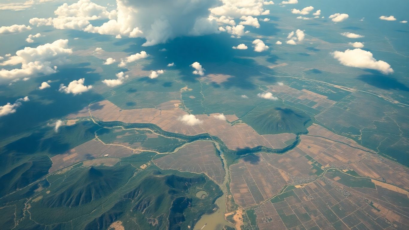
So, where exactly in Malaysia are we talking about when earthquake risks come up? It’s not a nationwide, uniform threat; instead, specific areas have been flagged based on careful geological studies. The Department of Mineral and Geoscience (JMG) has been hard at work mapping out the country's fault lines, and their findings point to certain states that need to be on higher alert.
States Identified as At-Risk
As it turns out, six states have been identified as being more vulnerable to seismic activity. These are Pahang, Terengganu, Perak, Negeri Sembilan, and, perhaps most notably, Sabah and Sarawak. This conclusion isn't just a hunch—it's grounded in a deep analysis of the earth's crust and its geological history. These are the states where our preparedness efforts need to be most concentrated.
Understanding Active Fault Mapping
How do geologists actually figure this out? A crucial part of the process is something called active fault mapping. Imagine drawing lines on a map to show where the ground has a history of shifting. These aren't ancient, dormant cracks; active faults are those that have demonstrated movement in relatively recent geological history. By studying these fault lines, scientists can get a much clearer picture of where stress might be building up—stress that could eventually be released as an earthquake. It’s a bit like an engineer looking for potential weak spots in a building's foundation.
The Malaysian Seismotectonic Map
Another vital tool in the kit is the Malaysian Seismotectonic Map. This is far from your typical road map. It’s a highly specialised geological chart that weaves together multiple layers of information. We're talking about data on tectonic plate movements, records of past earthquakes, and the precise locations of fault lines. All this information is combined to give us a comprehensive overview of seismic hazards across the country. It’s an indispensable resource for urban planning and development, helping to guide decisions on where new construction needs to be especially robust. You can explore more geological studies on seismic activity through resources provided by JMG.
Understanding these risk zones is the critical first step. It empowers us to channel resources and focus attention where they are most needed, ultimately making our communities safer when the ground inevitably decides to shake.
Key Hotspots for Earthquake Activity
When we discuss earthquakes in Malaysia, it's important to remember that the risk isn't spread evenly across the country. Certain areas are definitely more prone to seismic rumbles than others. Pinpointing these hotspots is crucial for directing our preparedness efforts effectively.
Sabah and Sarawak Hotspots
East Malaysia—specifically Sabah and Sarawak—experiences the most significant seismic activity in the nation. This is largely because of their proximity to the constantly interacting Philippine Sea Plate and Sunda Plate. The region is marked by several active fault lines, and any movement along these geological fractures can trigger earthquakes. The intensity and frequency of tremors in these two states are noticeably higher than in Peninsular Malaysia.
Key areas within Sabah and Sarawak that are under close observation include:
- The Interior Division of Sabah, which is located near the Sabah-Sarawak border.
- The northwestern coastline of Sabah, encompassing areas around Kota Kinabalu.
- Certain regions of Sarawak, especially those situated closer to the Indonesian border.
Peninsular Malaysia's Vulnerable Areas
While Peninsular Malaysia is generally considered to have a lower seismic risk compared to its eastern counterparts, it's not entirely off the hook. The primary concern here stems from distant but powerful earthquakes, particularly those originating from the Sunda Trench off the coast of Sumatra, Indonesia. These massive offshore quakes can generate ground shaking that travels and is felt across the peninsula. On top of that, there are local fault systems within the peninsula that can cause smaller, more localised tremors.
Some areas in Peninsular Malaysia that have recorded seismic activity or lie near known fault lines include:
- The northwestern part of the Peninsula, which feels the influence of the Sumatra fault system.
- Areas surrounding Bukit Tinggi in Pahang, which felt a series of notable earthquakes between 2007 and 2008.
- The western coastal regions, which are susceptible to tremors originating from Sumatra.
Johor's Recent Seismic Event
Even Johor, situated at the southern tip of Peninsular Malaysia, had a significant wake-up call in 2016. A tremor was felt strongly in parts of Johor Bahru and even across the causeway in Singapore, serving as a stark reminder that even regions not typically seen as high-risk can be affected. While its exact cause is still under study, the event highlighted the region's complex geology and the potential for unexpected seismic activity. It truly underscored the need for continuous monitoring and a reassessment of seismic hazards across the entire country—not just in the well-known active zones.
The occurrence of seismic events, even in places with historically low activity, drives home the point that no part of Malaysia is completely immune to earthquake risk. A solid understanding of our specific geological features and proximity to major tectonic boundaries is the key to identifying these vulnerable zones.
Government Initiatives for Earthquake Preparedness
It’s reassuring to know that the government is taking concrete steps to prepare the nation for potential earthquakes. They aren't just waiting for something to happen; there are clear, proactive plans in motion.
Updating Seismic Hazard Maps
This is a major priority. The government is committed to ensuring that the maps showing where earthquakes are most likely to occur are kept current. This helps everyone—from city planners to the public—know which areas require the most attention.
Building Code Compliance for New Developments
For any new construction, especially in those designated 'hotspot' areas, developers now have to play by a stricter set of rules. These regulations are all about making sure new buildings are designed to withstand ground shaking.
- Developers are required to consult the Malaysian National Annex to Eurocode 8.
- This standard provides detailed guidelines on designing structures for earthquake resistance.
- It ensures that appropriate seismic design and engineering practices are incorporated from the ground up.
Enhancing Monitoring and Early Warning Systems
While we still can't predict earthquakes, the government is strengthening the systems that detect them and issue timely warnings, particularly for tsunamis.
The main objective is to get warnings out to the public much faster. Currently, it takes about eight minutes from the moment an earthquake is detected to when a warning is issued. The goal is to trim that down to just six minutes by 2026. It might not sound like a huge difference, but in an emergency—every single minute counts.
All these efforts are geared towards one thing: making sure we are better prepared for any seismic events that may come our way.
Geological Factors Influencing Earthquake Risk
The Role of Fault Lines in Malaysia
When we talk about earthquakes, fault lines are usually the first thing that springs to mind. In simple terms, these are fractures in the Earth's crust where blocks of rock have slid past each other. Here in Malaysia, while we don't sit atop massive plate boundaries like Japan or Indonesia, we do have our own network of fault systems. Some are ancient, relics of geological activity from millions of years ago. It's the activity along these faults—even if it's slow or infrequent—that can lead to seismic events. Understanding where these faults are and how they behave is fundamental to assessing our earthquake risk.
Intraplate vs. Interplate Earthquake Sources
Earthquakes generally happen in two main settings. Interplate earthquakes are the big ones you hear about most often; they occur at the boundaries where tectonic plates meet. Malaysia isn't directly on a major plate boundary, so we're spared the most violent of these. However, we are close enough to feel the effects of the nearby Sunda megathrust, a massive subduction zone to our west. On the other hand, intraplate earthquakes occur within a tectonic plate, far from its edges. These are typically caused by stresses building up inside the plate itself, often related to ancient fault lines or ongoing adjustments in the crust. Malaysia gets a bit of both: we feel the shaking from distant interplate quakes in Sumatra, and we also experience potential intraplate events on our local fault systems.
Crustal Deformation Studies
So, how do scientists know if the ground is secretly moving or if stress is building up? That’s where crustal deformation studies come into play. Researchers use high-precision tools like GPS (Global Positioning System) to measure minuscule movements on the Earth's surface over time. By tracking these tiny shifts—we're talking millimetres per year—they can create a picture of the strain accumulating in the crust. This data is incredibly valuable; it helps us understand the forces at work and can point to areas that might be more susceptible to earthquakes in the future. It’s like listening for the Earth's subtle creaks and groans before it might shift more dramatically.
Here’s a simple breakdown of what these studies track:
- Movement Rates: How quickly different parts of the crust are moving in relation to each other.
- Strain Accumulation: Pinpointing where the crust is being stretched, compressed, or twisted.
- Deformation Patterns: Mapping how the landscape is changing shape, which can reveal active geological structures.
Grasping these geological processes isn't just an academic exercise. It directly shapes how we assess risk and plan for our safety. The ground beneath us is not static, and appreciating its slow, constant motion is a huge part of understanding why earthquakes happen where they do.
Understanding Seismic Hazard Assessment

So, how do experts actually determine where earthquakes might hit the hardest and how strong the shaking could be? This is the job of seismic hazard assessment. It's essentially the science of studying past earthquake activity and local geology to forecast the potential for future ground shaking.
Probabilistic Seismic Hazard Analysis (PSHA)
This is a really important method. PSHA attempts to calculate the probability of a certain level of ground shaking occurring over a specific time frame. Think of it this way: instead of declaring 'an earthquake will happen here,' it provides a forecast like 'there's a 10% chance of experiencing this level of shaking in the next 50 years.' It's a comprehensive approach that considers all possible earthquake sources, their potential sizes, and their distances from a site.
Here's a simplified glimpse into how it works:
- Identifying Earthquake Sources: This involves mapping out all known fault lines and seismically active zones.
- Estimating Earthquake Occurrence: Scientists then figure out how frequently earthquakes of different magnitudes might occur in those zones based on historical data.
- Predicting Ground Motion: They use specialised equations to estimate how intense the shaking will be at a particular spot, depending on the quake's size and distance.
- Combining the Data: Finally, all these pieces are woven together to calculate the overall probability of the ground shaking exceeding certain levels.
Deterministic vs. Probabilistic Approaches
There are two primary ways to look at seismic hazards. The deterministic method is more direct. It essentially asks, 'What is the absolute worst-case scenario earthquake that could plausibly happen here?' It focuses on a single, maximum-impact event. In contrast, PSHA, as we just covered, examines a full spectrum of possibilities and their likelihoods. For Malaysia, seismic hazard assessments have employed both methods, looking at metrics like peak ground acceleration (PGA) to gauge risks nationwide. These seismic hazard assessments are absolutely vital for safe and resilient planning.
The choice between deterministic and probabilistic methods really depends on the end goal. While a deterministic approach gives a clear 'worst-case' picture for critical infrastructure, the probabilistic method offers a more nuanced understanding of risk over the long term.
Ground Motion Prediction Equations
These are the complex mathematical formulas that help scientists estimate how much the ground will shake during an earthquake. They are developed by analysing vast amounts of data from past earthquakes around the world. These equations consider key factors like an earthquake's magnitude, the distance from the fault, and the local soil or rock type to predict outcomes like peak ground acceleration. A continuous effort is underway to refine these equations to better suit Malaysia's unique geological conditions.
Wrapping Up: What This Means for You
So, after all that, what's the takeaway? We've learned that earthquake risk in Malaysia isn't uniform. Certain states like Sabah, Sarawak, Pahang, Terengganu, Perak, and Negeri Sembilan are on a higher alert. Within these states, specific 'hotspots' such as Ranau, Lahad Datu, and Bukit Tinggi—and even some areas in Johor—require extra vigilance. On a positive note, the government is on the case, updating risk maps and enforcing stricter building codes for new constructions in these zones to ensure they can better withstand shaking. While no one can say for sure when the next tremor will occur, knowing which areas are more vulnerable helps all of us prepare more effectively. Being aware is, after all, the first and most important step toward staying safe.
Frequently Asked Questions
Which parts of Malaysia are most likely to experience earthquakes?
Based on geological studies, six states are considered to have a higher risk: Pahang, Terengganu, Perak, Negeri Sembilan, Sabah, and Sarawak. Within these, specific 'hotspots' like Ranau and Lahad Datu in Sabah, Niah in Sarawak, and certain areas in Johor, Pahang, and Selangor have shown more frequent earthquake activity.
What are 'active fault lines' and why are they important for earthquake risk?
Think of active fault lines as fractures in the Earth's crust that have moved in the past and have the potential to move again. Mapping these lines is crucial because it helps scientists identify where earthquakes are most likely to originate. The Malaysian Seismotectonic Map is a specialised tool that charts these fault lines and other geological data to help assess our country's earthquake risk.
Has Malaysia experienced earthquakes recently?
Yes, we do experience seismic events from time to time. A good example is the magnitude 3.5 earthquake recorded near Batu Pahat, Johor, which was linked to the Mersing Fault Zone. Although it was a mild tremor, it was felt in nearby districts, serving as a reminder that even smaller quakes can be noticeable.
What is the government doing to prepare for earthquakes?
The Malaysian government is taking several proactive steps. These include regularly updating the official earthquake risk map, enforcing stricter building codes for new constructions in high-risk areas to ensure they are earthquake-resistant, and improving our national earthquake monitoring and early warning systems.
Can earthquakes be predicted?
Unfortunately, no. Currently, scientists cannot predict the exact time and place an earthquake will strike. However, by studying fault lines, historical data, and ground movement, they can identify regions that are more prone to earthquakes. This allows us to assess the long-term risk and prepare communities accordingly.
What is a 'seismic hazard assessment'?
A seismic hazard assessment is a scientific evaluation that determines the likelihood of earthquakes in a specific area and estimates how strong the ground shaking could be. It's a critical process that provides the essential data needed for designing safer buildings, creating effective emergency response plans, and informing public policy.


